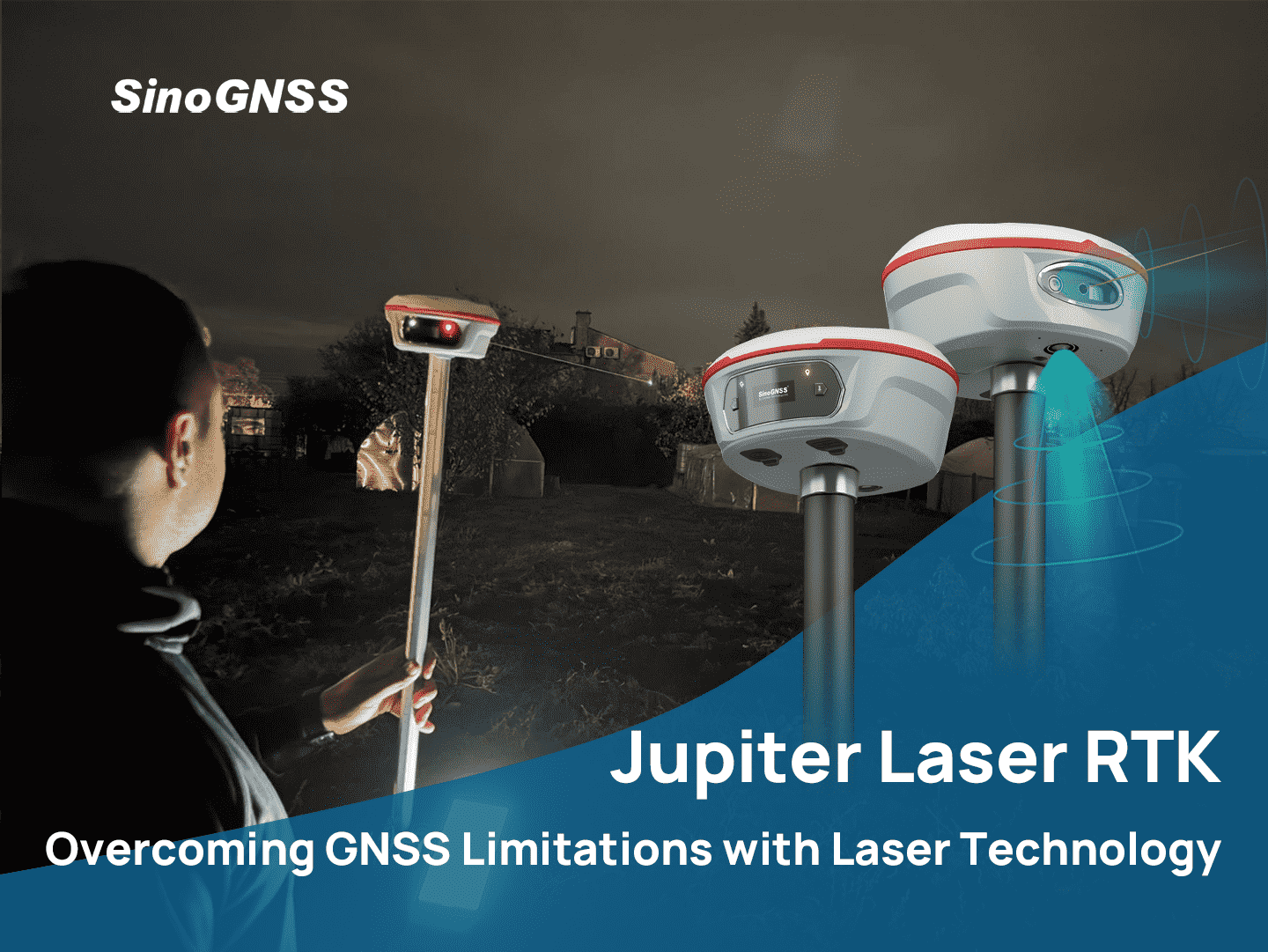

Jupiter Laser RTK: Overcoming GNSS Limitations with Laser Technology
Traditional GNSS receivers inherently require the device to be located with the measurement point, relying on continuous satellite acquisition and tracking at that location to generate a valid PNT solution. This dependency makes GNSS performance highly sensitive to local signal conditions. When the GNSS receivers are placed in environments with limited sky visibility, the number of tracked satellites decreases and satellite geometry degrades, directly impacting positioning accuracy and reliability.
Such limitations are frequently encountered in real-world applications. In surveying and mapping tasks near buildings, under bridges, along retaining walls, or beneath tree canopies, measurement points are often located in partially obstructed areas. As a result, users experience poor positioning precision, unstable solutions, or even complete loss of position fixes, despite nearby open-sky conditions.
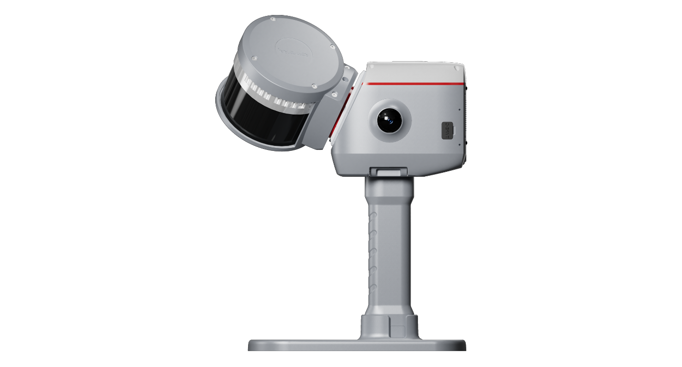
The solution is the Jupiter Laser RTK. It addresses this limitation through a laser-based complementary PNT approach. By using a precisely aligned laser to reference measurement points located in obstructed environments, the GNSS receiver itself can remain in a nearby open-sky position with optimal satellite visibility. The laser-derived spatial offset compensates for the separation between the receiver and the target point, enabling accurate positioning without compromising GNSS signal acquisition and tracking performance.
The Jupiter Laser RTK features a 50-meter green laser that enables accurate measurements even in signal-blocked areas. The laser’s visibility in bright daylight provides a reliable reference point, ensuring precision when GNSS is unavailable. In urban areas, the laser ensures that surveyors can measure distances accurately, even when satellite signals are obstructed by tall buildings or dense infrastructure.
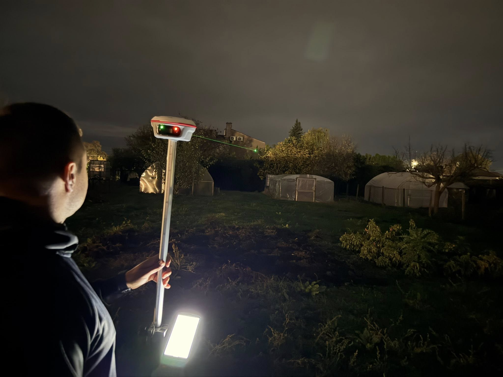
Photo provided by Nikolay Dimov
To complement the laser, the Jupiter Laser RTK integrates camera technology that provides real-time 3D visual guidance through Survey Master software. This system allows surveyors to follow directional arrows and distance readouts, enabling even less experienced operators to stake out points accurately without multiple adjustments. This streamlined workflow improves productivity and accuracy in complex surveying tasks.
The laser technology is particularly valuable in signal-blocked environments. In an example from an indoor parking garage, where GNSS signals are not available, the Jupiter Laser RTK allowed surveyors to stake out points from a safe, accessible location without needing to reposition equipment. The laser ensures accurate measurements, making the surveying process faster, safer, and more efficient, even in environments where GNSS would typically struggle.
The Jupiter Laser RTK is also highly effective in remote and hazardous environments, such as deserts and rugged mountain regions. In areas like the UAE, where shifting sand dunes and rocky terrain make traditional methods inefficient and unsafe, the device provides a reliable solution. Surveyors can measure from a safe distance, avoiding unstable ground while still achieving highly accurate results. The green laser ensures measurements remain clear, even under intense sunlight, a common challenge for traditional surveying tools.
In mountainous areas like Mount Abu in India, where steep slopes and limited satellite visibility are common, the Jupiter Laser RTK proves invaluable. It combines GNSS positioning with laser measurement to allow surveyors to obtain precise results without physically accessing difficult terrain. The device’s 120° tilt compensation feature ensures accurate measurements even when placed on uneven surfaces, reducing reliance on traditional leveling methods. This capability enhances both safety and efficiency in high-altitude environments, where traditional GNSS systems would fail to provide reliable data.

Photo provided by Pragnesh Shah
One of the standout features of the Jupiter Laser RTK is its IMU sensor, which compensates for tilt and ensures accurate data collection, even on sloped or uneven surfaces. This is particularly useful when traditional GNSS systems struggle to maintain accuracy due to terrain challenges. By combining GNSS, laser, and IMU technologies, the Jupiter Laser RTK allows surveyors to complete tasks quickly and accurately in complex environments without the need for additional equipment or manual adjustments.
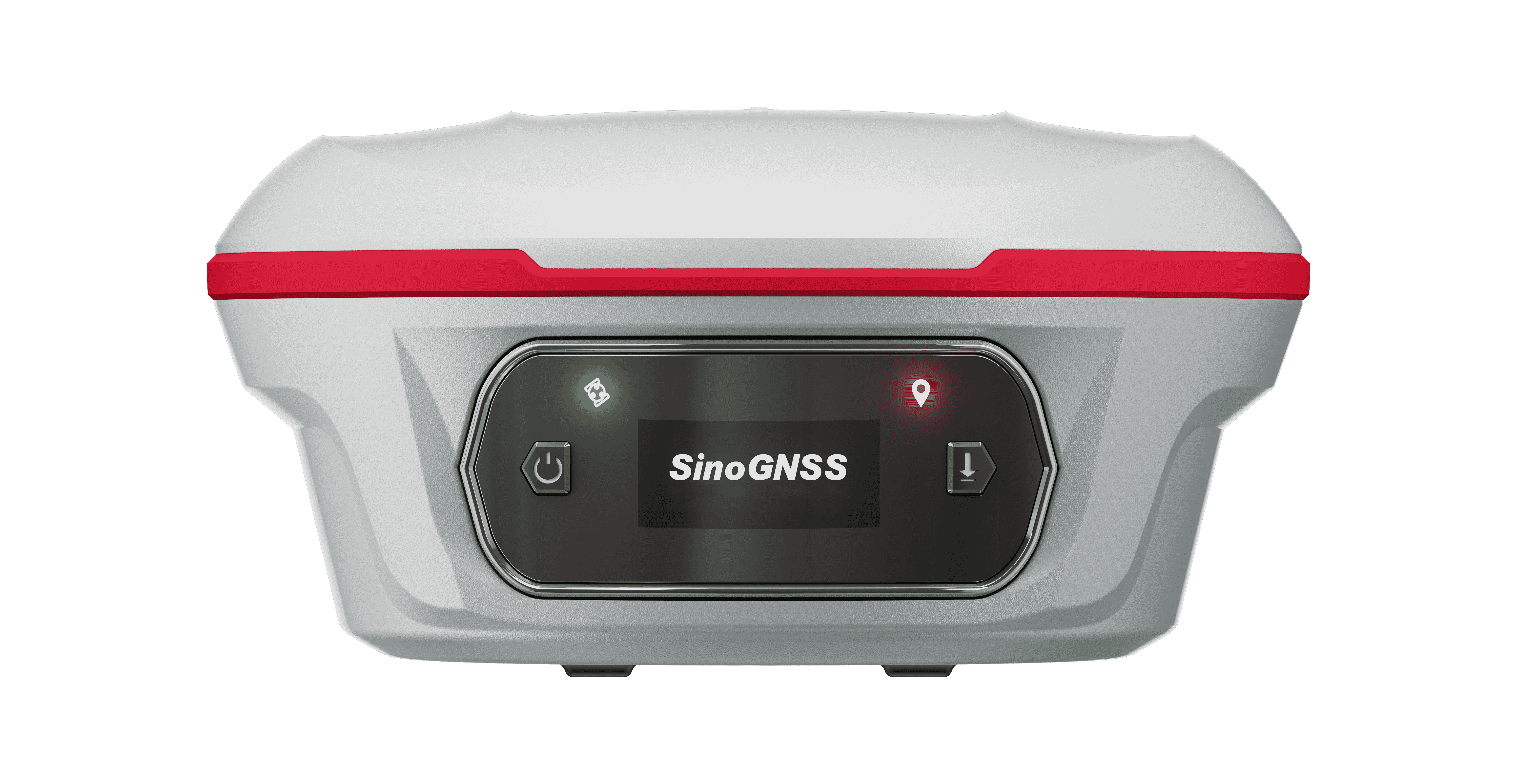
Another key feature of the Jupiter Laser RTK is its full-constellation GNSS tracking, supporting GPS, GLONASS, Galileo, and BeiDou. This ensures reliable positioning in a variety of locations, even when satellite visibility is limited. With fast initialization times, high reliability, and an IP67 rating, the system is ideal for time-sensitive projects and harsh environmental conditions, such as extreme temperatures, heavy rain, or dust.
In conclusion, the Jupiter Laser RTK is a groundbreaking solution that integrates GNSS, laser measurement, and IMU technologies into a single, reliable system. It overcomes the limitations of traditional GNSS systems, ensuring surveyors can work in environments where GNSS signals are blocked, unsafe, or hard to reach. Whether in urban canyons, rugged mountains, or remote deserts, the Jupiter Laser RTK provides surveyors with the tools they need to achieve high-precision results.
As industries continue to demand faster, safer, and more reliable surveying solutions, the Jupiter Laser RTK sets a new standard for modern surveying technology. By combining the strengths of multiple advanced technologies, it enables surveyors to tackle even the most complex challenges, ensuring they can deliver accurate results in the most demanding conditions. The integration of GNSS, laser, and IMU technologies makes the Jupiter Laser RTK a versatile and essential tool for today’s surveying needs.
About ComNav Technology
ComNav Technology develops and manufactures GNSS OEM boards and receivers for high precision positioning demanded applications. Its technology already been used in a wide range of applications such as surveying, construction, machine control, agriculture, intelligent transportation, precise timing, deformation monitoring, unmanned system. With a team dedicated for the GNSS technology, ComNav Technology is trying its best to supply reliable and competitive products to worldwide customers. ComNav Technology has been listed on the Shanghai Stock Exchange (Science and Technology Board), securities :ComNav Technology (Compass Navigation), Stock code: 688592.
About SinoGNSS®
SinoGNSS® is the official trademark of ComNav Technology Ltd., registered in People's Republic of China, EU, USA and Canada. All other trademarks are the property of their respective owners.
About ComNavTech®
ComNavTech® is the official trademark of ComNav Technology Ltd., registered in People's Republic of China, EU, USA and Canada. All other trademarks are the property of their respective owners.