SV600 Unmanned Surface Vessel
Introduction
Product Parameter
Download
Get Information
Introduction
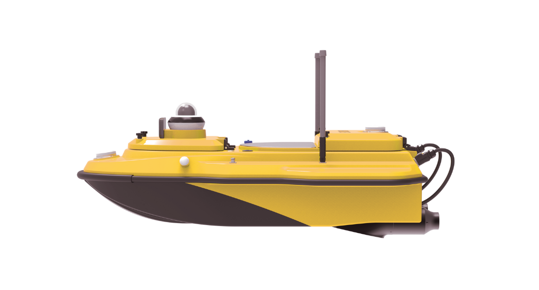
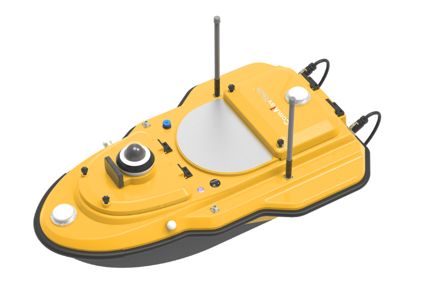
The SV600 is an advanced Unmanned Surface Vessel (USV) specifically engineered for hydrographic surveys. Offering remote control capabilities, it seamlessly integrates adaptive water flow straight-line and hovering technology for enhanced efficiency.


  • Integrate GNSS Antenna
  • Obstacle Avoidance Radar System
  • Quick Installation
  • IP67 Dustproof & Waterproof
  • High-speed Propeller with Long Life
  • Auto Measurement of Cross Section & Line
  • 360° Live Video
  • Integrated Master Control Design
01
Uninterrupted Positioning with GNSS+IMU
The SV600 is outfitted with SinoGNSS's dual-antenna GNSS module, featuring full-constellation multi-frequency tracking. This enables precise positioning and navigation. With an integrated IMU, it ensures continuous availability of position data, even during temporary GNSS signal loss.
02
Vessel Battery Status Display
Checking the battery status of the vessel is as easy as pressing button, eliminating the need to open the remote controller or access the cabin.
03
Streamline & Double Hull Design
The SV600 features a highly integrated master control that effectively minimizes the complexity of cables within the vessel's cabin. Its double hull design ensures its resilience against sinking and damage from unexpected impacts, safeguarding its integrity even in the face of unforeseen incidents.
04
Millimeter-wave Radar Automatic Obstacle Avoidance
With its advanced radar technology, the obstacle avoidance radar system ensures safe operations by detecting obstacles and providing timely alerts to users, allowing for quick and effective navigation even in low-visibility conditions.
05
Dual Moon Pool
With the capacity to carry payloads of up to 42kg, the dual-moon pool design provides ample space and strength to accommodate various scanning devices, offering versatility in hydrographic surveying.
06
Smart Remote Control
SV600 remote controller support radio and 4G connection. Its maximum communication range of network bridge is up to 2.5km. The controller is equipped with a 9.2'' screen that the image captured by camera can be viewed at any time, truly enhance the utility and compatibility.
Product Parameter
Vessel Specifications
Power
Communication
Positioning
Single Beam Echo Sounder
Vessel Specifications
Hull Dimension(L × W × H)1.18m x 0.7m x 0.39m
Material

Carbon Fiber

Composite Material

Hull ShapeTrimaran
Water Proof & Dust ProofIP67
Weight Without Battery24kg
Maximum Payload35kg
Draft9cm
Moon Pole23cm in Diameter (Customized)
Anti-wave & Wind3rd Wind Level & 2nd Wave Level
Equipable DevicesADCP, Water Sampling Equipment, Water Quality Meter, Sub-bottom Profiler, Side Scan Sonar, Single Beam Echo Sounder, Miniaturized Multi-beam Echo Sounder
Security ConfigurationShoal Automatic Astern,
Millimeter-wave Radar Automatic Obstacle Avoidance,
360° Life Video,
Dual-hull Anti-sinking Design,
Rubber Bumper,
Support Temperature and Humidity Detection,
Indicator Light for Vessle Operation,
Built-in Mounting Motor with Tangling-free Housing
Power
Battery Capacity33V/45Ah, Li-ion Battery,
Support Hot Swap
Propeller Type

Brushless DC

Direction ControlVeering without Steering Engine
Motor Power850W (Single Motor)
Maximum Speed3.5 knots (7 m/s)
Battery Endurance5.5h @ 2 m/s (Single Battery)
(Longer Battery Life Optional)
Communication
Transmission Range2.5 km (Network Bridge)
Unlimited Distance (4G Mode)
SIM Card Slot

Support Nano & eSIM

Video Communication4G, Network Bridge
Data Communication4G, Network Bridge, Radio
R/C Communication4G, Network Bridge, Radio 2.4GHz
Data StorageMulti-channel Storage
(Remote Controller, Vessel, Server)
Remote Controller9.2 Inches Display
(Support Different Memory, Vessel Control, Data Collection, Video Viewing, Working Modes Switch)
Positioning
Signal TrackingGPS: L1C/A, L2C, L2P
BDS: B1I, B2I, B3I, B2b
GLONASS: G1,G2
Galileo: E1, E5b
QZSS: L1C/A, L2C
SBAS: L1C/A
L-Band
Recapture Time

<1s>

RTK Initialization Time<5s>
Velocity Accuracy0.02m/s
Single Point Position (RMS)≤ 1.5m (Horizontal)
≤ 2.5m (Vertical)
PPP Accuracy≤ 10cm
RTK Positioning Accuracy±8mm+1ppm(Horizontal)
±15mm+1ppm (Vertical)
Heading Accuracy0.15° @1m Baseline
Roll / Pitch Accuracy0.25° @1m Baseline
IMU Update Rate200Hz
Single Beam Echo Sounder
Weight0.75 kg
Sounding Range

0.3 - 300m / 900ft

Sounding Accuracy

±0.01m ± 0.1% D

(D is the depth of water)

Resolution0.01m
Frequency200 kHz
Beam Angle
Supply Voltage9-15V DC, Less than 25w,
110~265V AC (Optional)
Water Proof & Dust ProofIP67
Download
  • SV600 Unmanned Surface Vessel.pdf(48.99MB)
    2024-08-23
Get Information

Product Name

Name *

Phone *

E-mail *

Company

Country *

    Inquiry Content