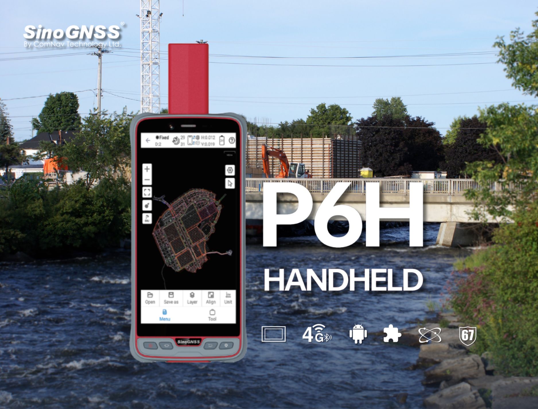

ComNav Launches New P6H Handheld for GIS: A Blend of Enhanced Precision and Superior Portability
Shanghai, China, January 16, 2024 - ComNav Technology LTD. introduces its new Handheld P6H, an advanced and rugged device tailored for Geographic Information System (GIS) data collection and outdoor operations. Featuring GNSS high-precision positioning module, rugged IP67-rated design, and 6’’ sunlight-readable display, the P6H ensures incredible positioning accuracy even in harsh environments.
High Precision Satellite Tracking and Positioning Technology
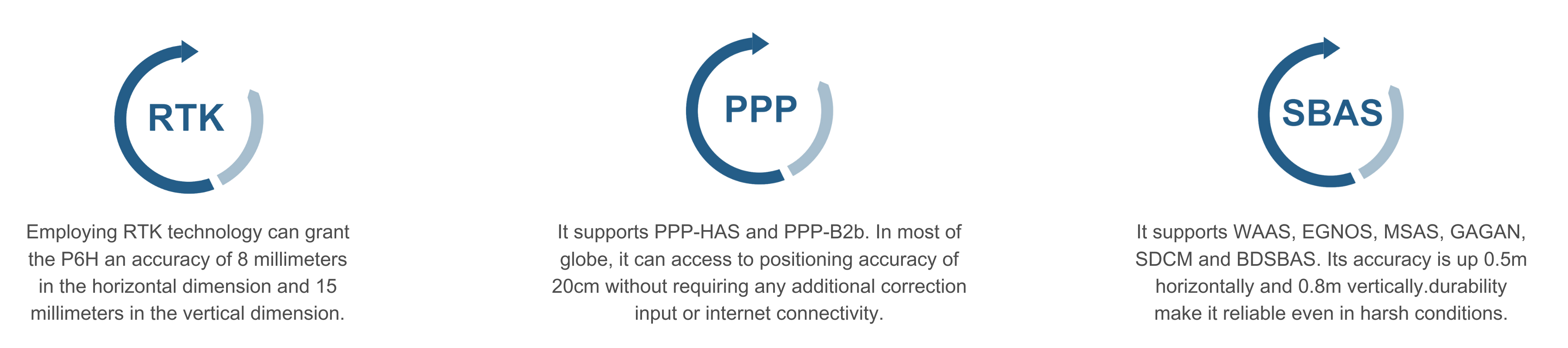
Equipped with SinoGNSS self-developed high precision K8 board and antenna, it tracks all running and planned constellations with 1590 channels, including GPS, BDS, GLONASS, GALILEO, QZAA, IRNSS and SBAS. Its accuracy remains at centimeter or decimeter level.
Outdoor Excellence with IP67 Protection and Sunlight Readable Screen
Its IP67 rating offers excellent protection against dust and water, suitable for tough environments. The addition of a 6600mAh removable battery with quick charging extends its operational capacity, ideal for prolonged outdoor use. Reliable in various conditions, such as heavy rain or dust, the device ensures efficiency and durability.
Moreover, the device features a Sunlight Readable screen with a 6-inch display for clear visibility in bright sunlight, reducing glare and reflections.This touchscreen, designed with a 5-point capacitive system, not only enhances user interaction by being intuitive but also accommodates diverse operational needs. It is adept at capturing data in various conditions, whether through the use of a stylus, while wearing gloves, or even with wet hands. Additionally, the device's ability to withstand drops from 1.2 meters height adds to its reliability, especially for professionals working in challenging outdoor conditions.

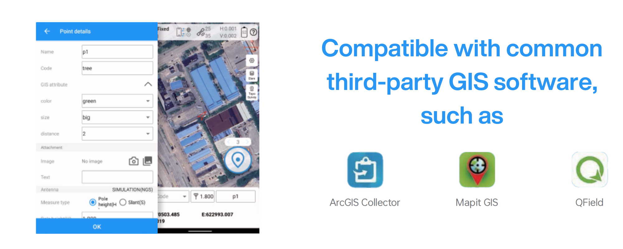
Compatibility with Common GIS Software
The P6H distinguishes itself not only in hardware but also through its exceptional software integration. It comes equipped with Survey Master, boasting robust GIS functions. These allow users to take measurements of geographic elements and store the results as attribute data for subsequent analysis, calculation, and visualization. It also includes a Mock Location function, allowing the sharing of Survey Master's accurate position with P6H. This enables third-party GIS software to access the same accurate position data. The function is suitable for users who prefer some third-party software rather than Survey Master, this ensures users have access to high-accuracy location data, facilitating a more effective and integrated use of various software tools in their professional tasks.
In addition to its integration with Survey Master, the P6H boasts compatibility with common GIS software such as ArcGIS Collector, Mapit GIS, and QGIS. This adaptability ensures its versatility as a tool for collecting and analyzing geographic data. Moreover, the P6H features an 8-core 2.0GHz processor, up to 128GB of storage, and up to 6GB of RAM, ensuring smooth software operation and efficient data processing. This integration enhances task efficiency.
Precision and Connectivity for Enhanced On-site Efficiency
The P6H handheld device, featuring a High Precision GNSS Module and Antenna, is tailor-made for efficient and precise on-site work. It incorporates 4G LTE, Wi-Fi, and Bluetooth® 5.0 BLE, enhancing its data transmission and sharing capabilities. This capability reduces data transfer and processing times, improving work efficiency, accelerating task completion, and ultimately boosting overall productivity.

Choose the P6H Handheld for your field operations and unlock a new level of productivity and reliability!
The P6H Handheld is a practical tool in various applications. For urban planners and managers, it offers reliable data collection, assisting in efficient urban development. In natural resource management, the device provides accurate data, aiding in responsible resource utilization. Its robust design is beneficial in emergency response and disaster management, where accurate information is crucial for timely decision-making. In academic fields like geography and environmental science, the P6H's precise data collection supports research and analysis. Its functionality in navigation and location-based services makes it a useful tool in our interconnected world. In agriculture, the device assists in monitoring and managing farming activities, contributing to more informed decisions in food production.


About ComNav Technology
ComNav Technology develops and manufactures GNSS OEM boards and receivers for high precision positioning demanded applications. Its technology already been used in a wide range of applications such as surveying, construction, machine control, agriculture, intelligent transportation, precise timing, deformation monitoring, unmanned system. With a team dedicated for the GNSS technology, ComNav Technology is trying its best to supply reliable and competitive products to worldwide customers. ComNav Technology has been listed on the Shanghai Stock Exchange (Science and Technology Board), securities :ComNav Technology (Compass Navigation), Stock code: 688592.
About SinoGNSS®
SinoGNSS® is the official trademark of ComNav Technology Ltd., registered in People's Republic of China, EU, USA and Canada. All other trademarks are the property of their respective owners.
About ComNavTech®
ComNavTech® is the official trademark of ComNav Technology Ltd., registered in People's Republic of China, EU, USA and Canada. All other trademarks are the property of their respective owners.